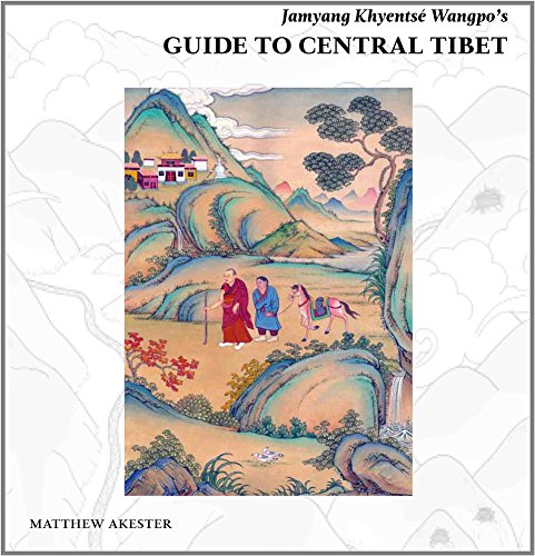
Jamyang Khyentsé Wangpo's Guide to Central Tibet Hardcover
Akeste Matthew

|
|
Editeur - Casa editrice |
Serindia Publications, Inc; UK ed. edition
|

Asia
Tibet
Cina
Himalaya
|
|
Città - Town - Ville |
London
|
|
Anno - Date de Parution |
2016
|
|
Pagine - Pages
|
824
|
|
Titolo originale
|
Jamyang Khyentsé Wangpo's Guide to Central Tibet
|
|
Lingua - language - langue
|
eng
|
|
|
|
|
|
|
|
|
|
|
|
|
|
|
|
 Jamyang Khyentsé Wangpo's Guide to Central Tibet Hardcover

La prima e più conosciuta guida del Tibet, composta dal più grande maestro moderno del buddhismo tibetano (Jamyang Khyentsé Wangpo 1820-92), è da tempo consultata da specialisti.
Fu tradotto per la prima volta dagli studenti di Giuseppe Tucci a Roma negli anni '50, quando lo studio accademico della cultura tibetana era ancora nel suo periodo formativo.
Questo libro è il risultato tanto atteso di una straordinaria avventura di ricerca, compilata nel corso di oltre un decennio di viaggi indipendenti, archeologia testuale, interviste sul campo con studiosi, monaci e abitanti dei villaggi, ricerche fotografiche e testimonianze della brutale distruzione e della trasformazione moderna di una terra antica. Negli anni Novanta, Matthew Akester percorse in lungo e in largo il Tibet centrale sulle tracce di Khyentsé Wangpo, visitando tutti gli oltre 200 luoghi elencati nella Guida, incontrando le persone che li ricostruirono dopo la Rivoluzione Culturale o che riuscivano a ricordare ciò che avevano vissuto. un tempo, ricercando fonti letterarie tibetane che gettassero anche la più debole luce sulla loro storia, e mappandole su un paesaggio reso irriconoscibile dalla rapida costruzione di un nuovo Tibet cinese. Questo libro è un contributo monumentale agli studi tibetani, un tesoro di approfondimenti sulla storia e sui monumenti del Tibet centrale, sul mondo del pellegrinaggio tradizionale e sulla vita e i tempi del grande Khyentsé Wangpo. Insolitamente, il testo è progettato per attrarre il lettore laico presentando al contempo una ricerca approfondita.
Per fare ciò, è diviso tra il testo principale utilizzando l'ortografia fonetica e le note a piè di pagina utilizzando la traslitterazione tecnica. A queste si aggiungono circa 250 fotostoriche dei luoghi descritti, 500 recenti, e una bellissima serie di 15 mappe in stile neotradizionale, pensate e disegnate per il libro, utilizzando i dati ricercati dall'autore. L'effetto è una presentazione a più livelli di un'ampia gamma di informazioni.
|
|
|
Recensione in altra lingua (English): |
|
The earliest and best-known guidebook to Tibet, composed by the greatest modern master of Tibetan Buddhism (Jamyang Khyentsé Wangpo 1820-92), has long been consulted by specialists. It was first translated by students of Giuseppe Tucci in Rome in the 1950s, when the academic study of Tibetan culture was still in its formative period. This book is the long-awaited result of an extraordinary research adventure, compiled over more than a decade of independent travel, textual archaeology, field interviews with scholars, monks and villagers, photo research, and bearing witness to the brutal destruction and modern transformation of an ancient land. During the 1990s, Matthew Akester walked the length and breadth of central Tibet in the tracks of Khyentsé Wangpo, visiting all of the more than 200 places listed in the Guide, meeting the people who rebuilt them after the Cultural Revolution or who could remember what they once were, searching out Tibetan literary sources that shed even the faintest light on their history, and mapping them on a landscape rendered unrecognisable by the rapid construction of a new Chinese Tibet. This book is a monumental contribution to Tibetan studies, a treasure of insight into central Tibet s history and monuments, the world of traditional pilgrimage, and the life and times of the great Khyentsé Wangpo. Unusually, the text is designed to appeal to the lay reader while presenting in-depth research. To do so, it is divided between main text using phonetic spellings, and footnotes using technical transliteration. Added to this are some 250 historic photos of the places described, 500 recent ones, and a beautiful series of 15 maps in neo-traditional style, designed and drawn for the book, using data researched by the author. The effect is a layered presentation of a large range of information. |
|
|
|